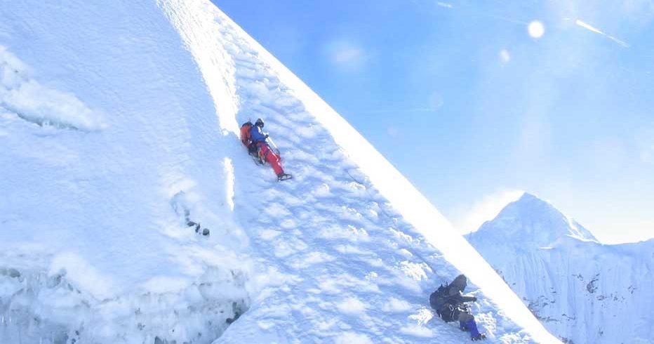
This magnificent peak rises as a giant shoulder of shining ice and snow. This is a conical peak on the northern side of Thapa (Dhampus) Pass and generally snow covered but not alpine in nature i.e. no crevasses.
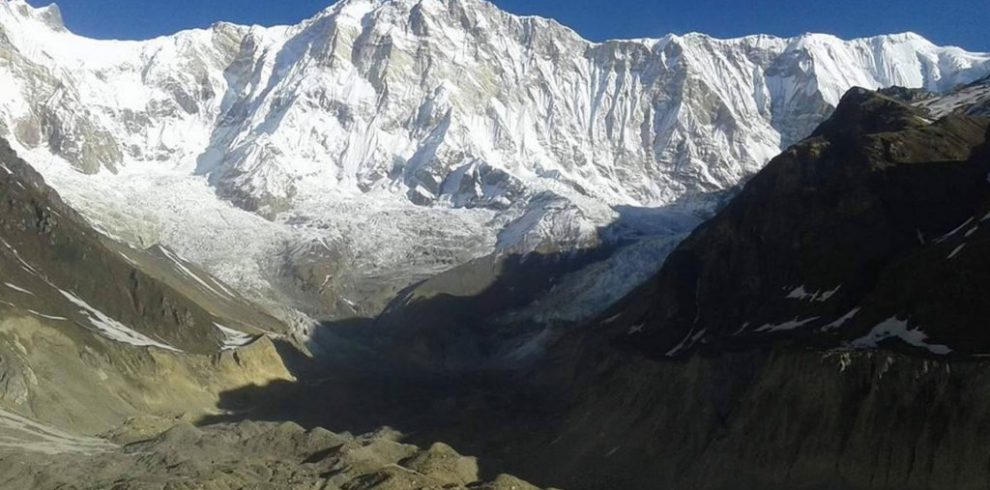
During this trip you can enjoy the magnificent views of Dhaulagiri 1- 8163m, Sita Chuchura 6611m, Nilgiri 6940m, Thapa Peak 6015m, Tukche Peak 6920m, Tilicho peak 7134m, Thorong Peak 6484m, Yakawa Kan 6482m, Puth Hiunchuli 7246m, Mukut Himal 6639m, Tangu Peak 6197m, Hongde peak 6556m, Tsarste 6347m, and more snow capped mountains.
Itinerary
Expand/Close
Drive from Kathmandu to Beni (830m.) by bus which takes ten and half hours.
Trek from Beni to Maldhunga (1300m.) which takes about six hours. Start Soon the rough rubble gives way to the smooth ice of the white part of the glacier. You climb steadily to the rough and chilling but spectacular Dhaulagiri Base Camp.
Trek from Maldhunga to Darbang and it takes about five and half hours.
This day you trek gently ascend for early one hour passing through jungles with varieties of oaks, rhododendron and so on. You can hear the chirping of the local birds then your trails follow quite flat land passing through stream at one place. The way you trek is muddy road crossing villages at some of the places. Darbang is a small village mainly inhabited by Magar and Limbus. There is a beautiful camping site. You can find small local shops with minimal supply.
Trek from Darbang to Takum which takes about 5 hours. This day also you trek ascend through narrow path for early one hour. Now you go along the flat land passing through jungle with varieties of rhododendrons, oaks and Christmas trees at some distance. After you cross a small stream, your trails suddenly begin to follow ascend path until you reach Takum. There is a government school before you enter Takum, a small village. Here you camp behind the school located in central Takum. You find a Hindu temple where the villagers go to submit their offerings.
Trek from Takum to Muri and it takes about 6 hours. You start trekking to descend trails for early one hour passing through jungle. Then you follow steeply ascent path and before you approach Muri you pass along the flat land until you reach Muri. This is a small village mainly inhabited by Gurung and Rai, one of the ethnic communities of Nepal. There are situated beautiful hotel offering attractive services to tourists guests who visit this particular area. You are here quite captivated by a Buddhist monastery.
Trek from Muri to Baghar(2080m.). Descend a gentle slope, and cross a rocky stream descend a path amid terraced fields to Dhora khola. Cross the river and climb to the right up the mountainside to Ghorban dhara. The view from this pass is fine, for the first time you can see Ghustung south (6465m). Follow the right bank path past Naura where you begin to ascend the mountainside. After climbing for a short while, take a path that traverses the steep grass-covered hill. The Myagdi khola assumes a steep-walled V-shape as the traverse ends and a high, winding path climbs the steep, grassy slope. The steep slope will not tolerate any missteps but the path is well-constructed with a great number of zigzag stone step paths. At last the long climb ends, and you enter a traverse to the right-here you must also beware of falling into the gorge of the Myagdi khola. Soon you descend through a forested area, emerging to a ridge snout where bagara (2080) is visible. Descend through terraced fields to this mountain village where you camp in people’s yards or the terraced fields.
Trek Baghar to Dobang (2520m.). Here you leave the villages behind and the trial becomes increasingly challenging.
Trek from Dovan to Upper Vungini (Italian Base Camp) which takes about 6 hours. Passing through the beautiful forest you rapidly gain altitude and mountains burst out all around.
Rest day for acclimatization.
Trek from Upper Vugini (Italian Base Camp) to Glacier Camp and it takes about 4 hours. After crossing the first glacier, probably using a rope in a couple of tricky spots, you climb onto the main glacier. The surroundings are spectacular which makes up for the rough and dangerous trail. we may also use a rope on this section. This is a particularly tough day. you camp on the glacier rubble.
Trek from Glacier Camp to Dhaulagiri Base Camp which takes about 5 hours. Soon the rough rubble gives way to the smooth ice of the white part of the glacier. You climb steadily to the rough and chilling but spectacular Dhaulagiri Base Camp.
Trek from Dhaulagiri base camp to French Col (5010m.) – Hidden valley which takes about four hours. You trek along trail covered with ice and soft snow. The stunning views of Dhaulagiri range completely enchant you.
Trek from French Col to Thapa pass (5015m) and it takes about five hours. The views are same as earlier day. This day you trek along flat path covered with ice and snow.
Rest at Thapa Peak Base Camp. This is an acclimatization day and you can make necessary preparation for Thapa peak summit.
Climb Thapa peak and back to Base Camp which takes about ten hours.
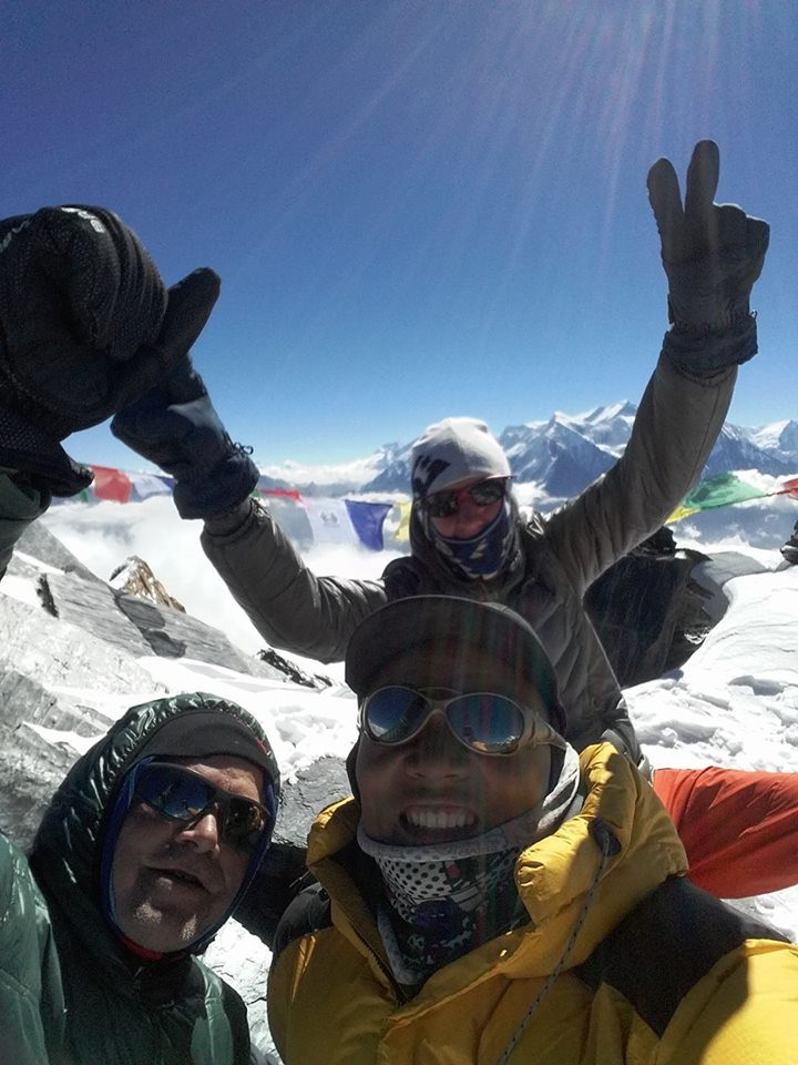
At the summit you will be enclosed by the views of Dhaulagiri I, Nilgiri, and Annapurna and so on.
Trek from Thapa Peak Base Camp to Yak Kharka and it takes about five hours. To reach your destination you trek leveled trail all the way. En route you pass Battase Danda. The views of Tukuche peak, Thapa peak, Annapurna range mesmerize you.
Trek from Yak Kharka to Marpha (2670m.) which takes about five hours.
This day the trail moves downhill till Marpha. On the way you pass small forests of juniper and other local vegetation. You will be accompanied by the splendid views of Nilgiri, Annapurna and rocky hills.
Trek from Marpha to Kalopani (2530m.) and it takes about five hours. You trek over flat path along the bank of Kali Gandaki. En route you pass Tukuche and Larjung village. These villages are pre dominant by Thakali and you find small monasteries, mani walls, chortens and prayer flags in these villages. The views of Dhaulagiri I and Nilgiri North with Tukuche add another dimension to your trek.
Trek from Kalopani to Tatopani (1190 m.) which takes about six and half hours. While crossing steeply descent path through forests you reach Ghasa (2010m.), a Thakali village. The surrounding area of Ghasa is famous destination for bird watching and wild Marijuana. Here you are quite amazed at the panoramic view of Mount Nilgiri North (7061m.), Nilgiri Central (6940m.), and Nilgiri South (6839m.) and others. From here, the trail descends steeply upto Rukse Chhahara (Rukse Waterfall) which is amazing to look at as it is the highest waterfall. There is situated the deepest gorge of the world between two mountains Annapurna I (8091m.) and Dhaulagiri I (8167m.) facing each other near Rukse Waterfall. The trail again descends slightly to Tatopani through different human settlements. You can enjoy the hot spring at Tatopani as the word Tatopani is termed after the natural hot spring situated at the bank of the Kali Gandaki River. It is popularly believed that taking bath in Hot Spring helps you to get rid of skin diseases. Along this, it gives you physical and mental refreshment as well.
Trek from Tatopani to Beni and it takes about six hours. Trekking over leveled path along the bank of Kali Gandaki you reach Beni. En route, you pass forests, villages, green hills, terraces and beautiful captivating sceneries.
Drive from Beni to Pokhara by bus which takes about five hours.
Drive from Pokhara to Kathmandu by tourist mini bus that takes about seven hours. While driving from Pokhara to Kathmandu, you head up to Damauli,, Dumre, Muglin and Kurintar where the Nepal’s first Cable car is operated to reach to Manakamana Temple. En route, you could enjoy the mountain views, green sceneries, rice terrace fields, vegetable fields and people being engaged in their daily life activities. From Naubishe you climb up to Thankot, the gateway to capital city. Or you can fly from Pokhara to Kathmandu and it takes about 25 minutes.

Write a Review
You must be logged in to post a comment.